TRANSLATION
Topographic survey.
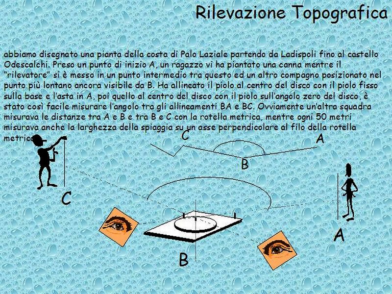
We have drawn a map of the coast of Palo Laziale starting from Ladispoli (Rome) up to the Odescalchi castle. Having a starting point A, a guy has planted a reed while the "detector" is set at an intermediate point between this and a peer located at the farthest point yet seen from B. He aligned the peg in the center of the disc with the fixed peg on the base and the pole in A, then the middle of the disc with the finger on the corner scratch disk, it was so easy to measure the angle between BA and the alignments CB. Obviously another team measured the distances between A and B and between B and C with the tape measure, and every 50 meters also measured the width of the beach on an axis perpendicular to the edge of the tape measure.
Topographic survey.
We have drawn a map of the coast of Palo Laziale starting from Ladispoli (Rome) up to the Odescalchi castle. Having a starting point A, a guy has planted a reed while the "detector" is set at an intermediate point between this and a peer located at the farthest point yet seen from B. He aligned the peg in the center of the disc with the fixed peg on the base and the pole in A, then the middle of the disc with the finger on the corner scratch disk, it was so easy to measure the angle between BA and the alignments CB. Obviously another team measured the distances between A and B and between B and C with the tape measure, and every 50 meters also measured the width of the beach on an axis perpendicular to the edge of the tape measure.